Space to Build, Bromley. October 2019
Housing targets and threats to Bromley’s protected land
CPRE London and local campaigners are very concerned about threats to Bromley’s protected green spaces and are working to identify alternative ‘space to build’
CPRE London is working with local campaigners in Bromley who are concerned about threats to Green Belt, Metropolitan Open Land and other green spaces in Bromley, to identify sites for housing to avoid protected green land being allocated for development.
Housing targets are the main concern because, where the local authority cannot show it has the necessary five year supply of sites for new housing, developers can appeal to the Planning Inspector to build on protected land
In July 2019 the Planning Inspector permitted a development on protected Metropolitan Open Land in Bromley, accepting the developer’s appeal argument that the Borough lacked the necessary 5 year supply of developable sites.[1] So these concerns are real and the lack of sites is already having an impact on Bromley’s protected green spaces.
In common with other London Boroughs, Bromley must find many more sites for housing than it had thought despite having issued many planning permissions
Bromley agreed a housing target as part of its recently adopted Local Plan of 641 per year over 10 years. However, the new Draft London Plan targets are much higher. In reality the borough must increase its targets or risk losing control over development.
| Bromley’s adopted Local Plan housing target | 641 per year |
| Draft London Plan housing target for Bromley | 1423 per year |
| 10 year average actual housing completions Bromley: source https://www.gov.uk/government/statistical-data-sets/live-tables-on-house-building | 667 per year |
| Current ‘pipeline’ i.e. permissions granted but not yet built | ? |
Building on Green Belt creates new problems and is not the answer
London’s Green Belt remains a vital and relevant part of planning policy and building on Bromley’s Green Belt would cause a great deal of harm. It would:
- encourage low-density, car-dependent development which does not make good use of land and which would add to congestion, noise and air pollution in a Borough which needs to reduce the proportion of trips made by car
- be ineffective in addressing Bromley’s housing needs which could be better tackled by developing strategic sites with good public transport links
- fail to deliver affordable housing (CPRE evidence has shown that Green Belt developments deliver expensive housing)
- fail to preserve the openness and permanence of the Green Belt, harming its integrity and amenity value for current and future generations (the potential of which is great and enhancements can and should be planned)
- entail the loss of good quality agricultural land which could and should in fact be put back to use to create a sustainable local food source for Bromley markets as per the GLA’s Farming in London’s Green Belt report of Dec 2018
- fail to recognise the important role Green Belt has in promoting regeneration of previously developed land within the existing urban footprint.
It is vital that new development does not add in more cars and traffic to the borough. Nearly a quarter of Bromley households already do not have a car[2]and this is likely to increase as older people and younger people move away from car ownership. Bromley therefore needs to consider catering for people who can use local shops and public transport. New higher density developments within the urban footprint can support car-lite and car-free homes in areas where people can, if they need to, use local shops and public transport. This will reduce the impact of new homes on congestion and air pollution while meeting local needs.
Developing in Green Belt is unnecessary: there is a viable alternative to build a better Bromley
Here we put forward recommendations and proposals for areas in Bromley which can be intensified. There are enough low-density, previously developed sites in Bromley which can be intensified to deliver much needed new housing while also expanding commercial space.
- Surface car parks and low-rise retail / commercial space
As per the London Plan, many commercial and industrial sites either make poor use of space (surface parking and low-rise buildings) OR are in need of regeneration and could be redeveloped to provide more modern facilities and, in some cases, be converted to mixed-use to incorporate new housing as well. In Bromley, there are only a few of this type of site and some of these are designated Strategic Industrial Land so a strong case would need to be made for conversion to mixed use and this would be difficult. Nonetheless, with consolidation of sites there is space for housing in some key locations, for example:
| Commercial industrial sites which could be intensified increasing commercial space but also adding in residential at around @260 dwellings per hectare | Hectares | Dwellings |
| Tesco Superstore on A223 at Ruxley | 6 | 1,560 |
| Mini/BMW sites Ruxley | 1 | 260 |
| Sites at Lower Sydenham Station (parts of this) | 3 | 780 |
| Sainsburys Locksbottom | 3 | 780 |
| Sites around Beckenham Junction station (including Waitrose) | 3 | 780 |
| 16 | 4,160 |
- Harnessing speculation to replace low density housing with higher density
We have also identified a large number of district centres or neighbourhoods, largely at junctions, which could be become more densely populated to create urban ‘villages’ or district centres which make local amenities and public transport more viable.
Currently developers are looking to acquire houses and other property in Bromley where they hope they can obtain planning permission for one or two extra storeys. Reputedly, for example, this speculation includes the section of Homesdale Road backing onto Havelock Rec. On Masons Hill (A21) developers have offered a £10,000 ‘option’ to neighbours to purchase their property when they want to sell. The council can channel this speculation and set policy to encourage this type of approach. This would:
- make a significant contribution to meeting Bromley’s housing targets
- provide security to developers to buy and offer an attraction for owners to sell
- halt the need to find green field sites
- create attractive neighbourhood centres for local shops, cafés, restaurants, etc
- promote the local economy and make buses more financially viable
- ensure development is consistent across a geographical location
- help council officers to manage piecemeal development by setting clear parameters.
How would this work?
- The borough would create a Special Planning Document setting out a policy promoting suburban intensification, at identified sites, to appropriate height, at junctions and residential roads near to stations. The policy might cover:
- maximum storeys for each site
- guidance on massing / appropriately staggered massing and use of curtilage
- style guidance to reflect local distinctive character
- siting of outdoor space away from road noise for road junctions developments
- provision of 1, 2, 3 or 4 bedrooms according to local need
- accommodating larger, family flats and providing safe communal garden/play space
- policy on affordable housing
- The council would then identify appropriate sites. We have identified over 30 sites which are examples of the type of site we believe would be suitable for such a policy (see https://drive.google.com/open?id=1iCkz0csN3OlijSJv5Ul7LYaVBXmDtMM) but we believe there are many more sites which could be included, possibly more than 100. Sites identified should include:
- sites with rows or groups of houses at road junctions particularly where it can act as a neighbourhood local centre
- sites rows or groups of houses within 800m of train stations
- housing and/or commercial buildings which make poor use of space.
The borough would draw up a document that specifies these sites (or rows and groups of houses that might be called ‘new neighbourhoods’). There should then be consultation on the process in particular with affected households and their neighbours.
- The policy and sites would then be promoted so developers can begin to negotiate purchase and draw up plans for redevelopment and the borough can establish a design panel or similar where developers are encouraged to engage at an early stage.
EXAMPLE ‘JUNCTION DEVELOPMENT’
B265/A21 ’Dripping Tap’ Junction at Homesdale Road and Bromley Common
Woodhouse apartments at the junction of Homesdale Road and Mason’s Hill is an example of a now-completed development which demonstrates what can be achieved. In the 1990s this junction was bordered by the Dripping Tap, a 3 storey rambling house used as plumbers showroom (much loved locally), Archers Court (a 3 storey commercial block, a bungalow and Cosmos House, a 4 storey concrete framed derelict office.
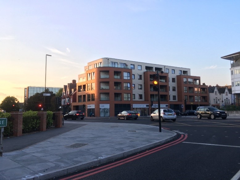
These evolved into the good quality 4-5 storey housing blocks that border the junction today. The new development retains commercial space (a Co-Op supermarket) underneath and now has 29 one and two-bedroom flats.[3] Nearby households also now benefit from the new supermarket.
Other sections of Homesdale Road South which were commercial buildings are now converted to 8 storey flats, and whilst this might be taller than is desirable in some areas, they are good examples of what might be proposed and encouraged around the borough.
Town cramming’ in Bromley Town Centre should be avoided
Bromley town centre can provide some space to build but proposals for high-rise blocks are not sympathetic to the historic town centre. It makes sense to remove surface car parks or multi-storey car parks to discourage short / switchable trips and commuter trips and to make way for new homes while helping deliver the Mayor’s Transport Strategy. But these must be ‘mid-rise’ and must not impact negatively on the town parks or the character of the historic town centre.
Bromley is a borough constrained by Green Belt and this should be reflected in its housing targets
Notwithstanding
the case made here for intensification, Bromley council should stress to the Planning
Inspector and London Mayor that, unlike other London Boroughs, it does not have
large areas of poorly used commercial land or large surface car parks which
could provide alternative space to build. It can and must therefore state
clearly that it is constrained by Green Belt and that targets should be lowered
accordingly.
[1] http://www.tetlow-king.co.uk/appeal-won-for-151-homes-in-metropolitan-open-land-in-south-east-london/
[2] Table KS404EW 2011 Census: Car or van availability, local authorities in England and Wales
[3] https://www.metro.news/hard-hat-area-square-deal-for-bromley/964894/
